Northern Patagonia Travel Guide: Beyond the Famous Destinations
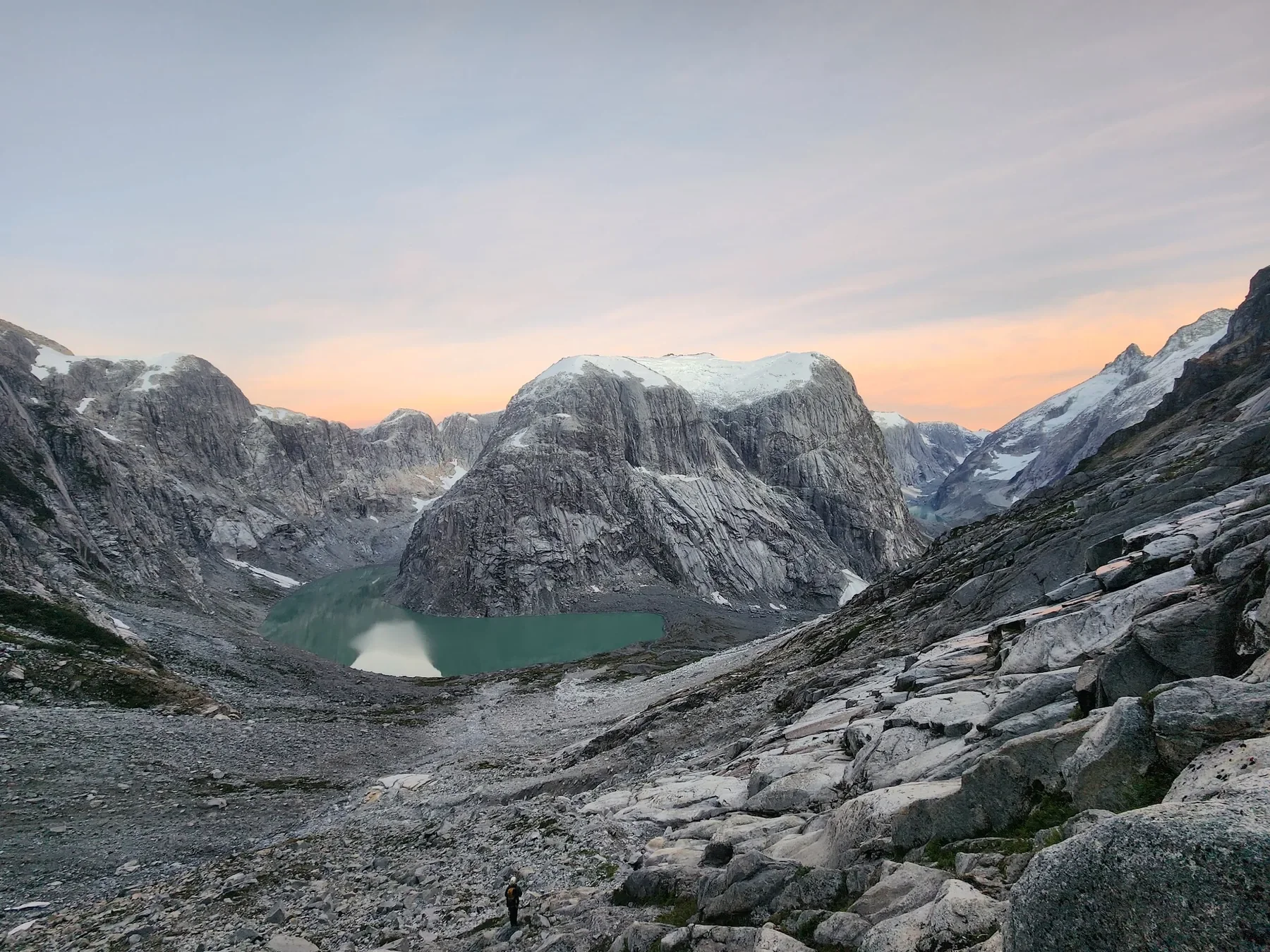
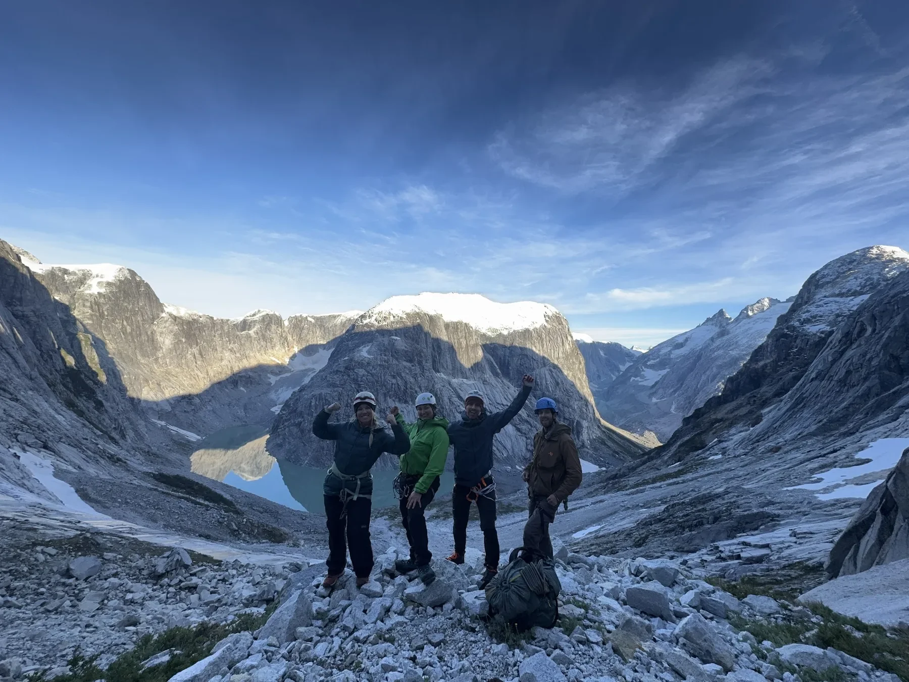
The magnificent mountains, glaciers, and walls of Rio Turbio.
Turquoise rivers. Old forests growing beyond human history. Icy volcanoes stretching into a wind-torn sky. Lonely deserts. Guanacos chasing each other into the distance. Armadillos crossing the highway. Ranches and refugios tucked high in the mountains between jagged granite peaks. Asados that burn late into the night with fire, wine, and song. Arrieros and their horses finding the path through the forest to deliver food, wine, and climbing gear to places no road will ever reach.
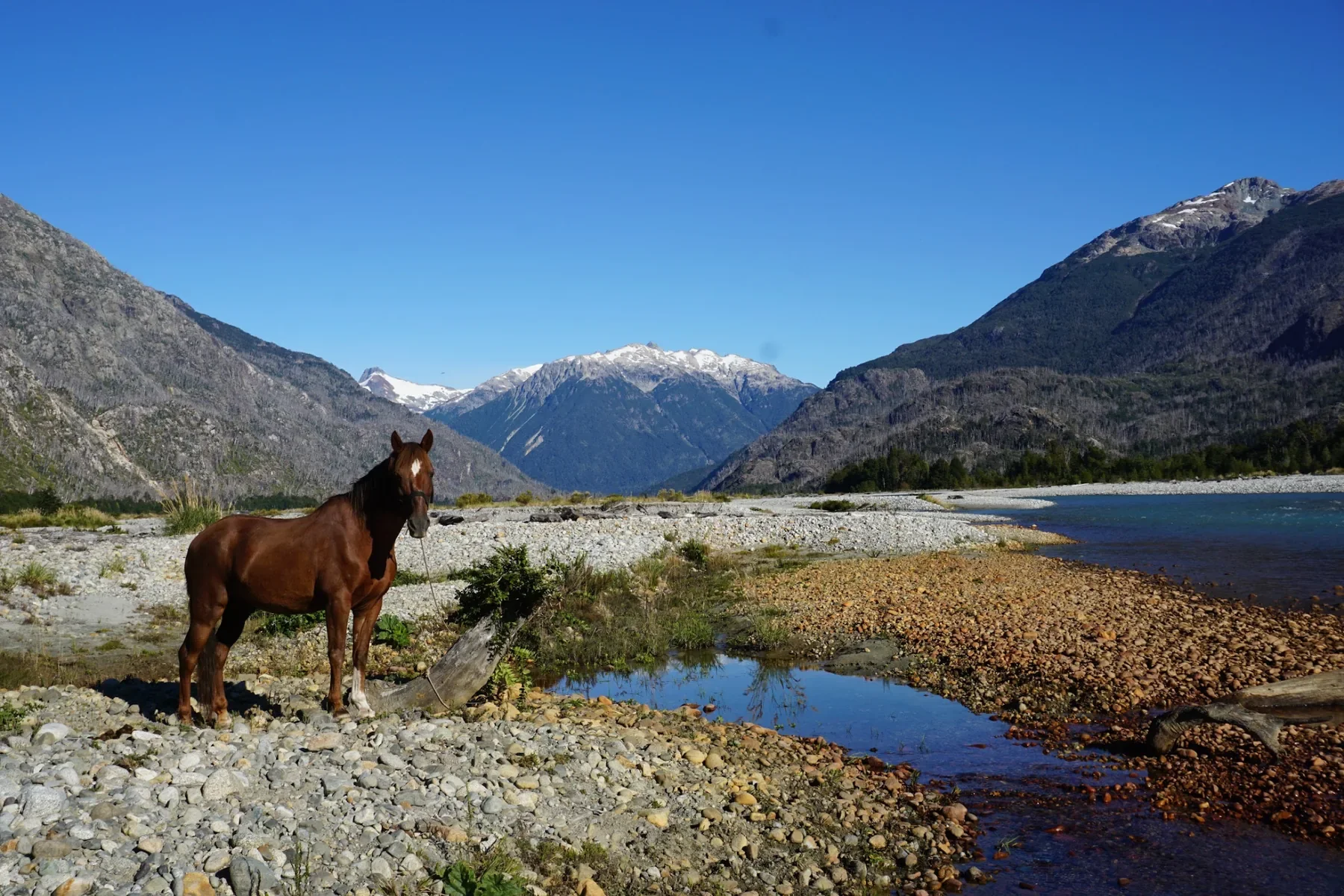
A gaucho’s horse in the middle of the Rio Turbio valley
Northern Patagonia is a place that sticks with you for the rest of your life.
We see thousands of travelers building the same checkbox itinerary — the same three towns, the same lookout points, the same photo everyone else has already taken. Below are the trips and places we recommend most, and the ones we wish more people came along with us to actually experience.
Where Is Northern Patagonia?
There's no official line anyone agrees on for where Patagonia’s northern boundary begins. Its southern end is easy to point to — the pointed tip of the continent, where the land turns to sea. For our purposes, we'll draw Northern Patagonia as everything south of, and including, the city of Bariloche in Argentina: Puerto Varas, Cochamó, Bariloche, El Bolsón, Lago Puelo, Río Puelo, and onward through remote crossings like Paso León, down to outposts like Río Turbio near the Chilean border. That’s an enormous stretch of the Andes — thousands of lakes, glaciers, forests, rivers, and wild country that most visitors never see.
So in a region that large, where do you even start?
Where We Operate
Peak Patagonia runs trips across the Patagonian Andes, the mountainous region shared by southern Chile and Argentina at the southern tip of South America. Most travelers fly into Santiago or Buenos Aires — the two national capitals, shown here for scale — then connect onward to the south. Our routes span the Lakes District near Bariloche, Puerto Varas, and the Cochamó Valley, roughly 1,000 km (620 mi) south of the capitals, as well as Río Turbio near Torres del Paine, further south still. Explore the map or the list to see each location.
Avoiding the Checkbox Itinerary
In a region this size, most people cherry-pick the postcard spots. As travel and the outdoors get more popular, places like El Chaltén and Torres del Paine get harder to book, pricier every season, and more crowded. You don't get a wilderness experience there anymore. The mountain culture of the region gets reduced to steak and red wine in a bistro packed with other tourists. Steak and red wine are great. But the culture that actually built this place — the arrieros, the refugios, the horse trails — gets skipped entirely in the rush to get the photo and move on. El Chaltén and Torres del Paine each receive over 250,000 visitors a summer. For the small towns that support that tourism, that's an enormous load to carry.
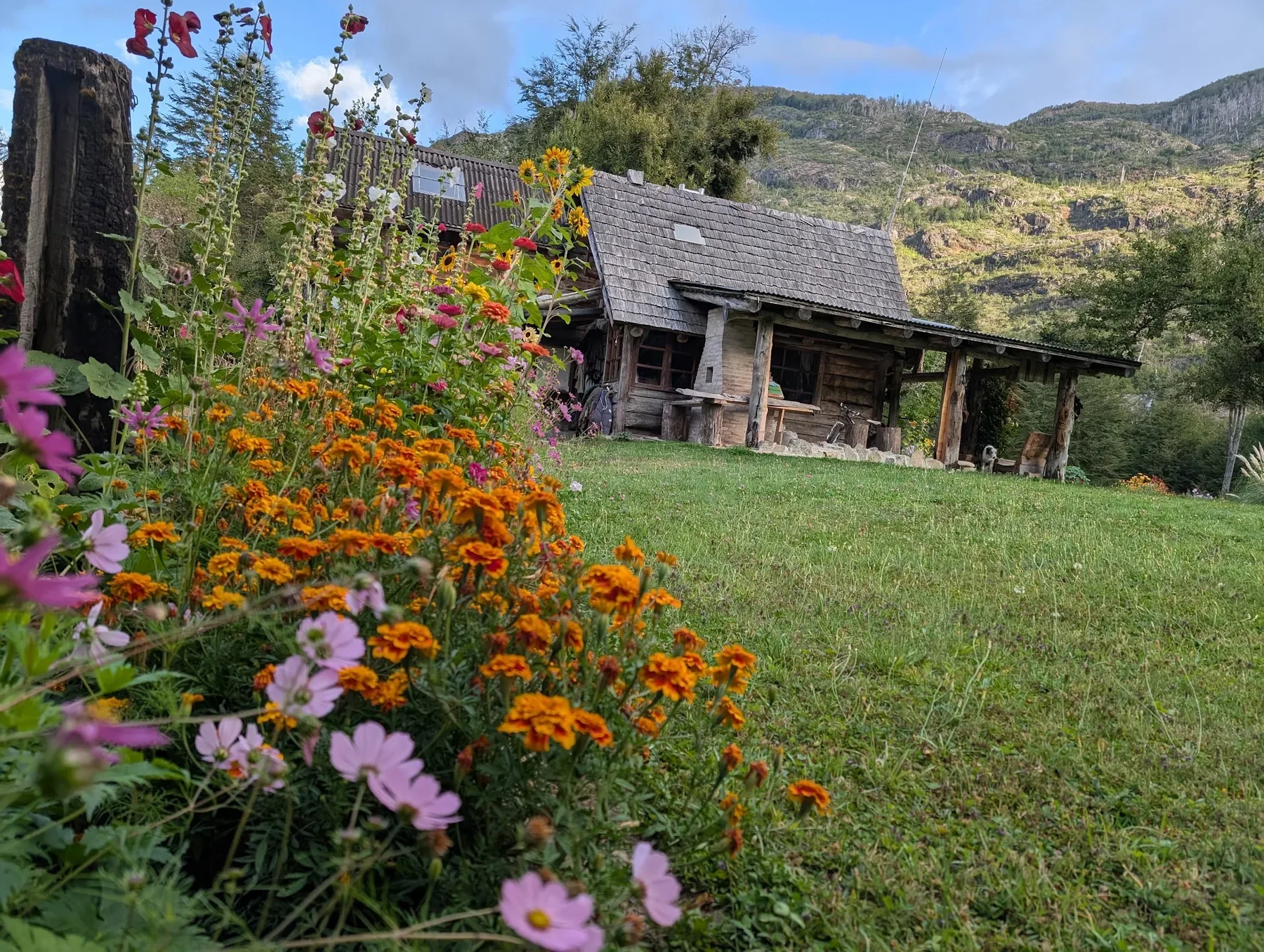
One of the beautiful ranches we stay at along one of our treks.
Should I Fly Into Santiago or Buenos Aires?
Both cities are worth a day or two on their own — museums, tango, food, architecture — before heading south. But logistically, they behave very differently.
Flying into Santiago is usually cheaper and simpler, even if Argentina is your final destination. Buenos Aires has a strange quirk: its international and domestic airports are in different parts of the city, so connecting from an international flight to a domestic one to Bariloche or El Calafate can mean up to 1.5 hours of driving between them, depending on traffic — a real headache if you're hauling gear.
Overland options favor Chile too. Santiago has cheap, reliable overnight buses south to Puerto Montt and beyond, and from Puerto Montt you can bus straight over to Bariloche. Buses in Patagonia are safe, affordable, and run often — we use them constantly. Just know your baggage limits before you show up; it's common to need to negotiate (politely) with the driver if you're over.
Buenos Aires to Patagonia by bus, by contrast, is a brutal, multi-day haul.
The distance from Bariloche to El Chaltén is also no joke — a rough, multi-day bus ride on unpaved road, or a flight that routes you back through Santiago or Buenos Aires. As of 2026, there are direct flights from Puerto Montt to Santiago and from Santiago to Bariloche; Sky Airlines is a reliable, affordable option on these routes.
Update to travel from Buenos Aires to Bariloche as of 10/13/26: Technically Bariloche IS an international airport. There are international flights from Brazil, Chile, and from Buenos Aires’s international airport. What this means is it is possible to not take a cab between the domestic and international airport if you book one of the flights to Bariloche that shows you leaving from the Buenos Aires Ezeiza International Airport and NOT Aeroparque Jorge Newbery.
Our advice: if you only have a couple of weeks, simplify. Pick one region and go deep with a single long wilderness trip rather than hopping between towns. Every flight and bus connection is a day you're not in the mountains. If you've got a month, then by all means, range wide.
After Santiago or Buenos Aires: Where to next?
Puerto Varas & Puerto Montt, Chile
These two towns are your Chilean gateway into Northern Patagonia, and worth a day even if you're only passing through. Puerto Montt has the airport (El Tepual) and the ferry docks; 20 minutes up the road, Puerto Varas sits on the shore of Lake Llanquihue — Chile's second-largest lake — facing the near-perfect volcanic cone of Osorno. Both towns were settled by German immigrants in the 1850s under a Chilean colonization program, and that heritage still shows: wooden churches, kuchen in every café, and architecture that looks more Black Forest than South America. It's an easy, walkable place to shake off jet lag before heading into the backcountry.
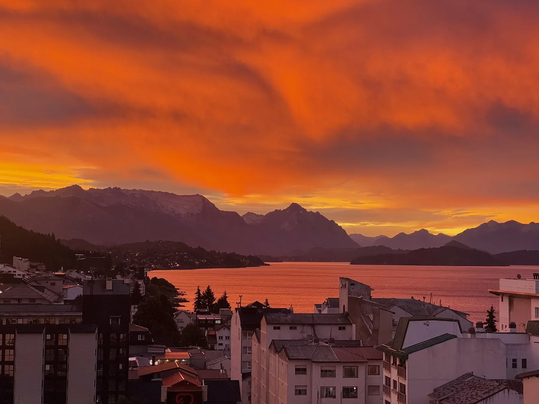
Bariloche, Argentina at sunset
San Carlos de Bariloche, Argentina
Bariloche is Argentina's adventure capital, sitting on the shore of Nahuel Huapi Lake inside Nahuel Huapi National Park — Argentina's oldest national park, established in 1934. It's the logistical hub for most of the trips on this list: outfitters, gear shops, buses, and flights all radiate out from here. This is where we live and play, and it's worth more than a layover — jump in an alpine lake, spend a rest day sailing the deep blue water of Nahuel Huapi, or just eat well and enjoy the town's chocolate and GELATO before heading into the backcountry. If you only have time for one multi-day trip from here, our 4 Huts itinerary is a local favorite: 4–5 days crossing the national park and summiting peaks along the way, sleeping in a different refugio each night — Frey, Jakob, Italia Manfredo Segre, and López — with food and drinks served at each stop.
The Places We Recommend
Cochamó Valley, Chile
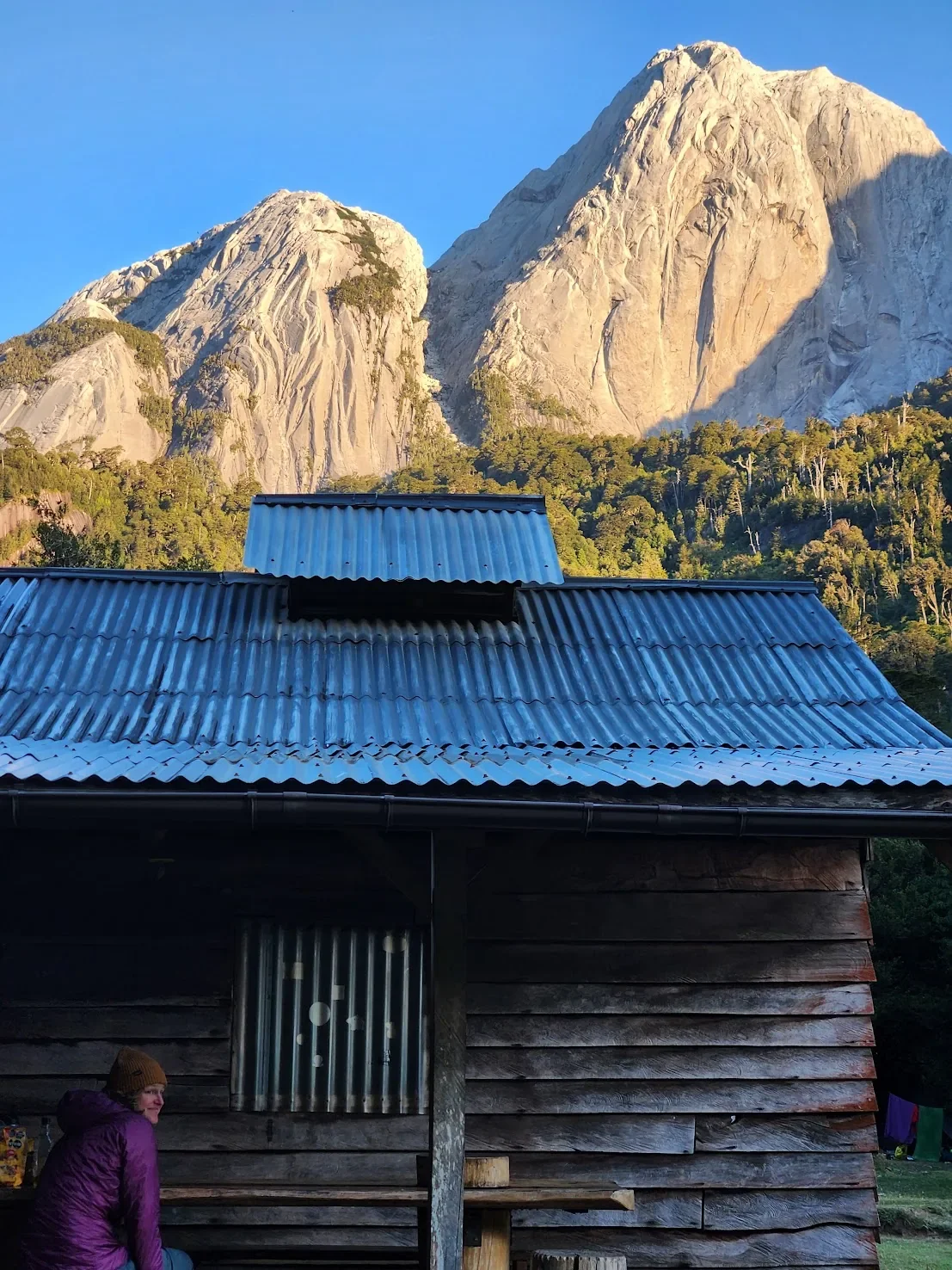
Mornings at La Junta campground in the Cochamó valley.
Closest town of access: Puerto Montt/Puerto Varas.
Cochamó is an epicenter to many — to the Chileans and folks who live in these mountains, and to the climbers from around the world who have fallen for its granite. The best way to experience it is simple: hike in from the coastal town of Cochamó and set up a basecamp at one of the valley's campgrounds (we recommend La Junta), and spend your days exploring on foot from there. Some of the valley's granite walls rise over 5,000 feet — big-wall terrain that has earned Cochamó its nickname, the "Yosemite of South America."
The valley's horse culture runs just as deep as its climbing. In 2013, Cochamó's arrieros — the badass Chilean cowboys who've moved goods and people through these mountains for generations — were officially declared Living Human Treasures by Chile's Cultural Council.
Cochamó's wildness wasn't guaranteed. Before the 2000s, only native families and arrieros lived here; word of the granite spread through English climbers first, then Brazilian, Argentine, European, Chilean, and American climbers followed. Development pressure came with the attention. Two decades of fighting between industrial, ranching, tourism, and conservation interests followed, until a major land purchase by Puelo Patagonia, The Nature Conservancy, the Freyja Foundation, Patagonia Inc., and the Wyss Foundation brought the valley under the Conserva Puchegüín conservation initiative. The New York Times covered the campaign here.
That protection matters more every year: the valley now receives roughly 15,000 visitors in a short summer window. Pack out your trash, and never start a fire in the backcountry.
For a true backcountry experience, book a trip with us and we’ll show you where the gems are after over a decade of exploring the area.
Río Puelo, Chile
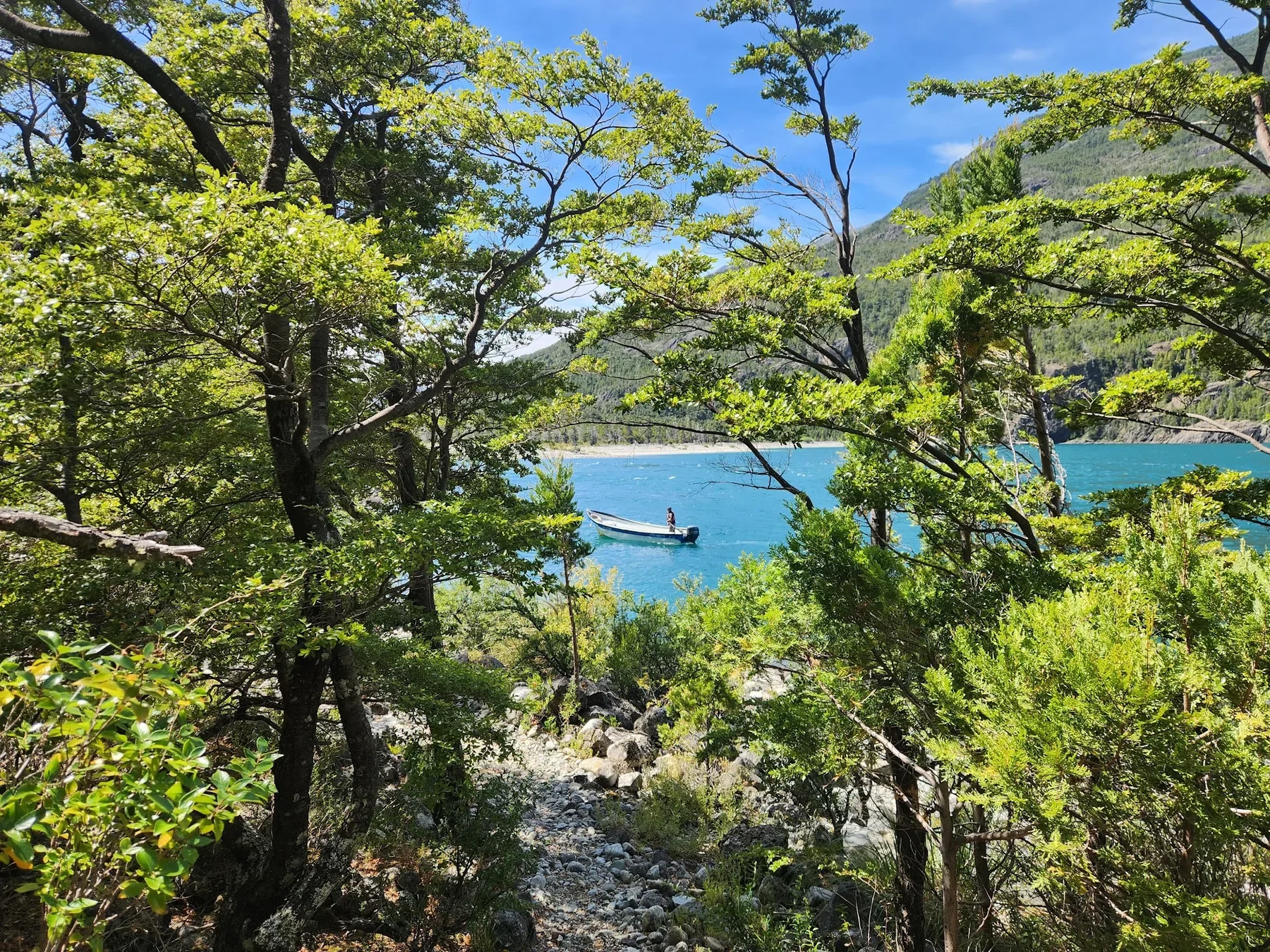
One of the amazing boat drivers of Rio Puelo going back home after dropping me off.
Closest town of access: Puerto Montt/Lago Puelo.
If Cochamó is Northern Patagonia's climbing capital, Río Puelo is its whitewater capital. The river itself shifts color with the weather — turquoise one day, deep blue the next — as it winds down from the Argentine border through glacial valleys to the Reloncaví Estuary. From Puerto Montt, it's about 90 kilometers to Puelo, including a ferry crossing of the estuary. Our favorite way to access it is by hiking across the border from Lago Puelo after a beautiful boat ride. It’s a 4-to-6-day route that starts in the town of Lago Puelo, Argentina, and finishes across the border in Llanada Grande, Chile — adjustable between more hiking and more boat crossings depending on your group's ability. See more about that boat trip here: https://www.peakpatagonia.com/crossingtheandes
Fishing season here runs from September to May, one of the longest in Chile, and the entire region sits within the World Biosphere Reserve of Temperate Rainforests of the Austral Andes. Bring cash (there's no ATM in Puelo), a rain jacket even in summer, and be ready for the tábanos — horseflies that show up in force in January and are drawn to dark clothing.
Class 2–4 whitewater rafting and packrafting are also available on this stretch, logistically supported out of the Hostal Puelo Libre.
Refugio Frey, Argentina
Closest town of access: Bariloche.
A short but steep hike from Bariloche's Cerro Catedral ski area, Refugio Frey sits at 1,700 meters on the shore of a glacial lagoon, ringed by more than thirty granite spires between 20 and 250 meters tall. It's one of the most iconic alpine climbing destinations in Argentina — trad routes from moderate to hard, climbing season running December through March, with February typically the driest month. The hike in is about 11–13 km depending on your route, with 800–1,000 meters of elevation gain — doable as a long day trip, but staying overnight (the hut sleeps around 40) is where the place really opens up: a sunset drink and pizza at the refugio, with the granite spires lit up above the lake. We run this as a 2-day overnight trip year-round, suited to hikers with little previous experience.
Tronador & Pampa Linda, Argentina
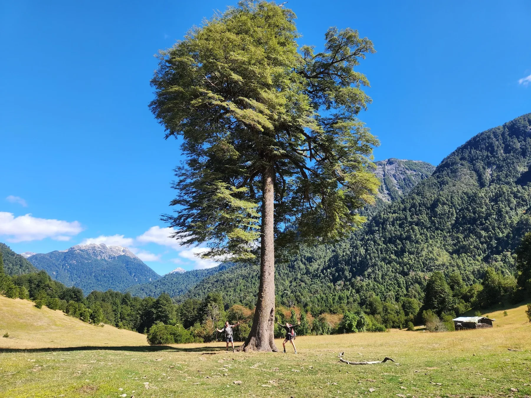
Vuriloche!
Closest town of access: Bariloche.
Monte Tronador — "The Thunderer," named for the sound of calving ice — is an extinct volcano straddling the Chile-Argentina border, and one of the most important glacier systems in Northern Patagonia, with seven glaciers spread across both countries. Pampa Linda, a small settlement at its base reached by a scenic gravel road along the Manso River, is the jumping-off point for everything here: short walks to the Ventisquero Negro (Black Glacier), longer treks like Paso de las Nubes, and technical routes up onto the ice for those with proper glacier experience and a guide. All of Tronador's glaciers have been retreating since the mid-20th century — this is a landscape that's visibly, measurably changing, and worth seeing while you can.
We run two ways to experience it. A 3-day trip crosses from the Manso river valley to Nahuel Huapi lake, finishing with a boat crossing on the lake itself — good for travelers who want the glaciers and the rainforest without a full border crossing. For the bigger adventure, our Vuriloche route follows one of the oldest paths through the Andes: start in Bariloche, overnight in Pampa Linda beneath Tronador, cross into Chile on foot the next day to meet border police in a genuinely remote setting, then continue past hot springs, remote ranches, glaciated rivers, and native alerce forest to Lake Cayatué — finishing in Puerto Varas. Six to seven days, moderate difficulty, previous trekking experience required.
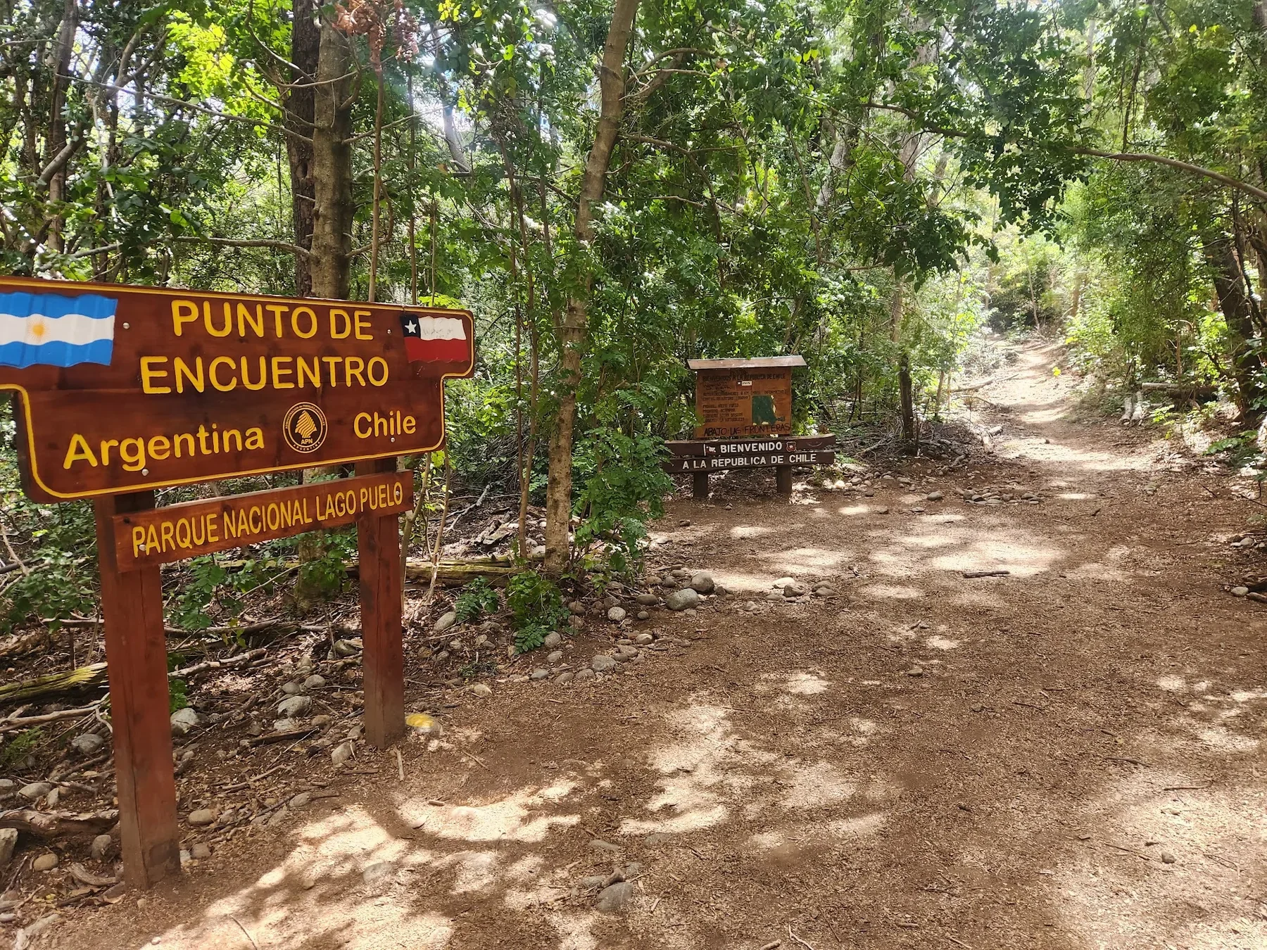
Paso León (Chile–Argentina border)
Closest town of access: Bariloche.
This is Northern Patagonia at its most remote: a roadless border crossing along the Manso River, reachable only on foot, horseback, or by the local gendarmería boat across the river itself. Every December 8th, the crossing hosts the Encuentro de Hermandad Chileno-Argentina, a binational gathering that's as much about the shared culture of these mountains as the geography.
Our Paso León route is a 9-day trip: starting in Bariloche, Argentina, you walk 5 days to reach La Junta in the Cochamó Valley, where you base-camp, day-hike, and explore the higher valleys for a few days before finishing in Puerto Varas, Chile. It's rated low-to-medium difficulty and works for beginner-to-intermediate hikers — the border crossing itself is remote, but the trip is built to be accessible, not just for hardened backcountry travelers.
To top it off, the trek goes straight through Cochamó. Combining the trek with a full exploration of the valley at the end is highly recommended.
Río Turbio (Turbio IV), Argentina
Closest town of access: Bariloche/Lago Puelo.
This one, sometimes called "Turbio IV" (pronounced Turbio Quatro), is a remote valley about 60 km southwest of the town of Lago Puelo, and it's the closest thing left in Patagonia to true unexplored terrain. It happens to be the author’s favorite place on earth!
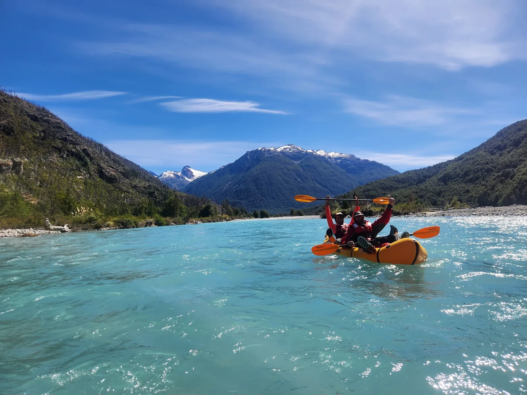
There are no roads in. The trip starts with a boat across Lago Puelo, then gauchos and horses to carry gear up the valley, crossing rivers and a couple of Tyrolean traverses along the way. Giant alerces — cousins of the redwood — grow straight out of granite walls that have barely been climbed; local climbers Leo Viamonte and Sebastián de la Cruz were among the first to explore and climb here back in the 1980s, and new routes are still being put up today. Chinook salmon run upstream through the river's opal-clear water. You'll sleep in backcountry huts with names like Don Ropo and Don Chule, and the trip out is a multi-day float back down to Lago Puelo by packraft. The backcountry huts are out of a fairy tale: one of them is literally built on top of a giant granite boulder.
Packrafting the river out on the final days is a dream and a real treat after all the hard hiking.
For a more detailed description of the trip visit our page here.
This isn't a place you stop by on your way to somewhere else — it's the somewhere else. Plan on 9 to 15+ days depending on whether you're hiking, mountaineering, or combining it with packrafting, and go with a guide who already knows the gauchos and the route; there's still no reliable map of the place and all the resources for getting up the valley (horses, ranches, refugios) are hard to get in touch with. Get in touch with us to help book a trip!
Frequently Asked Questions
When is the best time to visit Northern Patagonia? Summer (December–February) offers the most stable weather and the longest days, and is the season for climbing at Refugio Frey and trekking around Tronador. Shoulder seasons (October–November and March–April) bring fewer crowds and lower prices, though weather is less predictable.
Do I need to procure a visa in advance in Argentina or Chile? Nope, just show up.
How many days do you need in Cochamó Valley? Plan for at least 4 days: one to hike in and set up basecamp at La Junta, two full days for day hikes and exploring the granite walls, and one to hike back out. Climbers or those wanting to combine Cochamó with the Puelo River should plan closer to a week.
Do I need a guide for Northern Patagonia's backcountry? Many day hikes near Bariloche (like Refugio Frey) don't require one. A guide is highly recommended for the off trail section of 4 Refugios. But for glacier travel on Tronador, multi-day valley crossings like Paso León, or horseback routes through Río Puelo, a local guide is strongly recommended — the terrain, weather, and river crossings can change quickly, and local knowledge of routes and conditions is not something you can replace with a map. The best way to put it is: Patagonia is full of secret treasures and local knowledge. You WILL benefit from having someone who knows the area go with you and share the region’s culture, generosity, and deep connection to the mountains with you.
What's the difference between Northern and Southern Patagonia? Northern Patagonia (the Lakes District, roughly Bariloche and Puerto Varas south to Río Turbio) is greener, forested, and volcanic. Southern Patagonia (El Calafate, El Chaltén, Torres del Paine) is drier, windier, and dominated by the Southern Patagonian Ice Field — and, increasingly, by tourist volume. It has much colder winters.
Is Northern Patagonia safe for travelers? Yes, generally — violent crime is low, and the outdoor culture is well established. The real risks are environmental: fast-changing mountain weather, remote river crossings, and long stretches with no cell signal or rescue access nearby, which is why local guiding matters more here than the crime rate does.